13.7 miles, via Bilton Hall, Nidd Gorge, Bilton, Knox, Jennyfield, Oakdale, Birk Crag,
RHS Harlow Carr, Beckwith, Lund House Green, & The Warren.
 |
Long Distance Trail
means Selfies!
#2 at Knaresborough. |
There's no early start to today's trek as a 4+ pint session from last night has to be slept off, after seeing off another colleague from my department at the hospital, and when we do get to depart from Knaresborough station, we're overdue after the train crew had to deal with a fare-dodger at Harrogate, and because I'm apt to fart around at this station that has already been dubbed the prettiest in the county, not getting underway until after 10.25 am, and the day ahead isn't going to be short. Feel fortunate that's we've got the sunshine out again as the descent down Water Bag Bank is made to rejoin the Harrogate Ringway trail, seeing the facades of Waterside being shown to the best effect, and allowing ourselves a detour to the riverbank to see the early morning row boaters already out and the old bridge carrying the A59 across the Nidd being shown up in a good light. Rise to the main road and over the river, passing The World's End and Mother Shipton's cave before we depart Knaresborough without really having seen enough of it, entering Mackintosh Park and the beginnings of the Nidd Gorge green space, initially following the Beryl Burton cycleway, named for the Seven times World Champion, and local girl, who dominated road and track cycling in the 1960s. We gain a leafy path as the ringway ascends away from the river, denying us any views towards the stately Conygham Hall on the opposite bank, recombining with the cycleway to follow a field boundary uphill, where all the views are found by looking back to see Knaresborough's castle and parish church rising above the riverside foliage. The shady track eventually leads us out to Bilton Hall, also hidden from view and these days forming a retirement and care home, and a country lane leads us onwards, in the direction of Old Bilton (a name that you'll soon notice starts to crop up all around these parts), and the sunshine passes from the morning, and a cool wind blows in to remind you that Summer does not bring guaranteed warm days. A northward shift comes as the path leads us on to the Nidd Gorge proper, following a rough path into the woods, following a line that doesn't seem to correspond with the one on the map, but the destination should be obvious if the descent is continued as the river must be located at the bottom of the valley, carved through the carboniferous and Permian sandstones by post glacial runoff after the last Ice Age.
 |
| Harrogate Road bridge, Knaresborough. |
 |
| The Beryl Burton Cycleway. |
 |
| Bilton Hall driveway. |
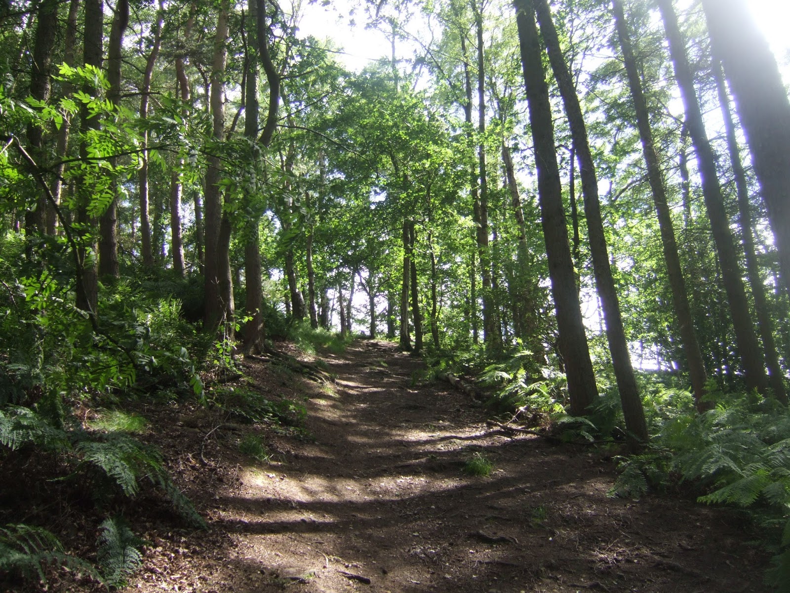
 |
| The descent into the Nidd Gorge. |
Finally attain the bottom, after a long decline into the ravine with many steps and sticky patches, meeting the riverside as the Nidd squirts over the modest rapids that have formed down here, and way-finding should prove easy enough as the path to follow must be the one that hangs closest to the bank and doesn't wander too far uphill, and that we set course westwards around the loop that the river forms, meeting more people than might be expected down here, considering just how relatively inaccessible this southern bank seems to be. Under the tree cover and with steeply rising banks on both sides, it's easy to convince yourself that you are quite far removed from civilisation, but that's not really the case as the north bank has several access points and paths to it, coming down from the B6165, really not all that far away above the trees to the north, but we can convince ourselves of the solitude, even as we pass the footbridge and sole low level crossing point in the valley, a place that you can only experience intentionally as we will be having no incidental traffic down here. The path takes on a lot of different characters as it goes along Bilton Banks, sometimes rising and falling a lot, and wandering at a relative remove from the bank at times, and often having a decent firm surface, and other time sitting on duckboards to pass over sections that have gotten muddy or tenuous. There aren't too many good vistas up or down stream as we go, the dense canopy of trees providing a lot of green shade, and the twists of the gorge means that the Nidd rarely has any sections that can be seen for more than a few yards, and the disappointment is compounded by the lack of sunshine, only seen sporadically to offer any opportunities for high contrast photography. There are a few nice open section and beaches to be met along here, ideal for a picnic for those with enough malice aforethought, but not good on a chilly stretch like we're experiencing, so we pace on with the river riffling and pooling, to eventually get sight of something else man made, with the sheds of Bar Farm appearing on the north bank, and then the river starts to make noise and the paths start to wander up the bankside as we approach Scotton Mill, the only former industrial site in the gorge. It's all residential now, naturally, and I'll stick to the lowest path to get best sight of it across the Nidd as the noise of the weir fills the air, and even this path rises high as the bank steepens precipitously, eventually dropping down to get a good sight of the falling waters and a view downstream that suggests that the ford that supposedly exists below it is just as unusable as the one at Netherby on the Wharfe (so don't try plotting that route for any future trips in these parts).
 |
| The Nidd Gorge footbridge. |
 |
| The Nidd in High Contrast. |
 |
| The Nidd in Low Contrast. |
 |
| Scotton Mill and Weir. |
Press on, as the Nidd Gorge seems to have been going on for a while, westwards to meet the outspill of Bilton Beck, soon passed over to meet the end of the gorge and the real point of interest for me, which is naturally another railway relic, Bilton (or Nidd) viaduct, built for the Leeds & Thirsk railway in 1947, taking traffic to Ripon and Nidderdale until its closure in 1967, a completely unnecessary loss to the network, and an impressive edifice to conclude the riverside walk. Still, its seven lofty arches form a pleasant backdrop for our lunch break, as we steel ourselves for the cool breezes to be met once we've moved away from the river, tracing the perimeter of the sewage works that process all of Harrogate's waste water, and rising to meet a field path that leads us to a tree lined path that draws us on up to the outer suburban edge of the town. We won't be going into it just yet as the path takes us past the back gardens we meet, and on west through the enduring greenery to meet a track along the edge of a large plot of allotments, still tracing the edge of the sewage works before we enter Knox Country Park, where the locals can exercise their animals and themselves whilst we can tack along the path that appears to correspond with the one on the map, before meeting the final western edge of the Nidd Gorge green space, one of Harrogate borough's true natural gems, methinks. So we enter the suburbia, of Bilton (see, that name is everywhere!) and the 1980's looking sprawl doesn't appeal to me at all, but the road names are suggestive of something more interesting as we pace our way up Old Barber and Old Trough Way to find our way out of town again on Knox Lane, nut before we leave the sight of bridge abutments at the roadside pique my interest as I'd had no knowledge of there being any former railway out here, far from the former metals of the NER and its constituents. It turns out to be the remains of the narrow gauge line that once ran from Bilton Junction to the town gasworks on Ripon Road, operational for coal transport from 1907 to 1956, and a fascinating discovery to stimulate the mind as we lapse out into the country again, passing the nicely upscale terrace on the lane as it leads us to the now absent ford over Oak Beck and the tiny 17th century Spuristy packhorse bridge that still stands, still very useful to all traffic smaller that a bicycle. The hamlet of Knox lies beyond, looking most desirable in its older parts, but also proving to be a magnet for some rather unappealing additions on the rising lane up past Knox Mill, which seems to be a recurring theme about this town, soon left behind as we elevate to meet the A61, which give us the feeling that we must be well past the half way point by now, with the western half and downhill stretch back to Pannal still to come.
 |
| Bilton (or Nidd) Viaduct. |
 |
| Knox Country Park. |
 |
| The Former Harrogate Gasworks Line, Knox Lane. |
 |
| Spruisty Bridge, Knox. |
So set off down a farm driveway before the path takes us a turn southwards on a track flanked by thick hedges, and after too many miles passing without any views towards the town centre coming along, we finally get a vantage point that provides this for us, which confirms my impression of this being a town without notable tall buildings, as one spire and only two tower blocks show up on the eastern horizon. It's fields and not much else off to the west as the track wends its way around Grange Farm, made over as a holiday village by the looks of it, down towards the A59 Skipton Road, where development is encroaching on the north side and Cow Dyke farm is looking in dire need of redemption, meeting its edge for a short distance before passing over Saltergate Beck and into suburbia again. On we go up into the Jennyfield estate, along one of those green passages that seem to be put in place just to make the houses feel that bit less crammed together, rising to Jenny Field Drive and taking a turn towards the town, as there seems to be a dearth of obvious rural paths on this side of Harrogate, and it's one of those wide roads that feels like it ought be going somewhere but really doesn't, sweeping greenly between the low rise houses and giving plenty of space for both cyclists and pedestrians. More interesting walking arrives as we meet the substation and the leisure centre as the path slips across Oak Beck, returning to the landscape, meeting a path concealed by many trees on its southern side, at the edge of two more estates of vintages of 30+ years apart, and it feels like we might have a long walk on the wooded edge coming along, but soon the path rises to meet Oakdale Glen as we have to pass around the upper edge of Oakdale golf course's club house. A shady track follows, and a return to the walk that was expected, rapidly dropping downhill to a pleasant little glade that sits alongside Oakdale Beck, with the fairways of the golf course on the northern side, and once again we have a nice clear route to trace along the beckside, with much more undulating than you might expect beneath the tree cover, passing a little arched bridge hidden away near its end. The rise away is sudden and sharp, and might not have even been the correct path, but this elevates us uphill to lead us out onto Kent Road, which also feels unnecessarily wide and directionless, but also rather unadopted and aspirant suburban at the western edge of town, leading past some very large houses before we land on Cornwall Road and hit a switchback uphill to get us more elevation before we head onto the woodland stretch on to Birk Crag, revealing the fact that despite being a relatively flat sort of town, Harrogate's Ringway path is going to find every route to exercise you and illustrate the many folds in its local landscape.
 |
| West of Harrogate, the town centre peeks into view. |
 |
| Jenny Field Drive. |
 |
| Oakdale Beck, and Golf Course. |
 |
| Kent Road. |
So onwards into the slanted woodland, past the Scouts and Guides hut, and tracing what feel like it ought to be the right path, not drifting too far downhill, passing below various disused quarries and staying relatively level as the primordial feeling wood slopes downhill pretty sharply, though not enough to discourage plenty of rougher paths from criss-crossing it, with a relatively long plod carrying on to eventually meet a long flight of steps to bring us up to the woodland top, to really exercise the calves and lungs. We arrive above Birk Crag, with its impressive gritstone outcrops being rather obscured by the trees, and even on the top of the rocks, the views are marred by a lot of foliage, but they do illustrate well the fact that beyond Oakdale, the folds of lower Nidderdale are really not that far away from today's trail, only a couple of miles as the crow flies beyond the army barracks and the wind farm. After a watering break, we continue as the path drops from the crag top, revealing more rocks hidden away in the woods, sidling downhill to meet the turn into the delightful little glade that has formed around the fall of Harlow Beck, a natural depression below a high canopy of trees that is enhanced further by the sunshine returning to the day, and we've got duck boards and a footbridge to pass over before we rise steeply up around it, meeting another tangle of paths and a switchback that takes us to the boundary of RHS Garden Harlow Carr. This explains the various garden features that hide away from easy access beyond a chain-link fence, following the perimeter path as the sunshine beats down on the meadows to the west and the noise of festivities of some sort drift from the gardens adjacent, eventually leading us out to the B6162 Otley Road, which is followed up to the town boundary and the garden entrance, gaining enough elevation to gain a hint of upper Nidderdale on the northern horizon. Turn south, past the new development for North Yorkshire constabulary on Beckwith Head Road, which seems to be closed for development work beyond the stud farm, but a lack of detour and ongoing work means I'll wander on among the machinery and carved up earth to meet the crossroads that leads us on to the farm cluster, or mini-hamlet, of Beckwith. There's some fine views across to the empty lands to the west, along with it's familiar high points, and it's nice looking spot above the Crimple valley, ideal for a country dwelling that doubles as an active farm, and it's from here we start our first actual field walk of the day, aiming to the south east across the fields of Blue Coat farm and over to Lady Lane, and the even smaller hamlet of Lund House Green, which has you wondering if two farmsteads can actually constitute a settlement.
 |
| Birk Crag woods. |
 |
| Harlow Beck glade. |
 |
| Beckwith Head Road up. |
 |
| Beckwith hamlet, or farm cluster? |
Field walking continues, again not taking the most direct route as the end of the day draws close, and trouble is immediately had by running into a group of herding bullocks, who are not happy to meet me in their field, but might have also mistaken me for a farm hand as some backing off and stick waving has them soon driven from my path, and we can continue as the field walk drives on towards the southern edge of Harrogate, where the numerous dairy Friesians are found to be thankfully much more placid beasts. Take a sudden and sharp turn southwards, tracing a vague route that wanders between various field boundaries, where the gates turn out to be the best navigational aids, starting a drift downhill as a familiar woodland and pair of river valleys give us some familiar sights as the trail starts to feel close to concluding, and entirely illusory feeling as there are still a few turns to come once we have passed over Hill Foot lane. A landscape groove takes us downhill, past Bilton Grove farm (our last Bilton of the day), through much rough greenery and over the young Crimple beck by Maw Hill farm, before attention can turn forwards to The Warren, a short way along across Brackenthwaite Lane, a pleasantly shady woodland of conifers and evergreens to meet at the end of the day's hot spell. It provides a tough uphill walk though, sat on the hillside edge between the branches of the Crimple, and it also conceals old quarry remnants and a good spot for some off-road cycling before we exit it close to the highest point, getting views to both sides of the hillside and its valleys, pausing for a late watering as the view across to Harewood and Lower Wharfedale is absorbed and appreciated. Meet the path walked just last weekend, but don't quite close the loop on the Ringway just yet, instead taking the direct route via field edge and paths previously avoided in the direction of Burn Bridge, and meeting the track that heads along the southern edge of the Crimple, heading among farm and mill buildings that have had the makeover treatment and finally get the beckside walk that I'd hoped for behind the gardens of suburban Pannal. Emerge onto Mill Lane by the millpond and carry on by the country terraces and semi-rural retreats to land on Station Road, only a short distance from the actual station, but the loop must be closed by passing over the Crimple for one last time to return to the church of St Robert of Knaresborough, at 4.40pm, concluding the whole Harrogate Ringway in about 9 hours of total trekking. That was clearly plenty of miles to have been wisely spread over two days, and there's only five more minutes to add to the day as we pace back through suburban Pannal to conclude the day at the railway station, nowadays mostly occupied by the local Co-op, and that might be it for my days on the West Riding's circular trails, as the next obvious 'local' choices would seem to be a bit on the remote side.
 |
| Field Walking, and Bullocks, at Lund House Green. |
 |
| Field Walking to Hill Foot Lane. |
 |
| The Warren. |
 |
| Crimple Beck or River Crimple, Pannal. |
5,000 Miles Cumulative Total: 2842.7 miles
2017 Total: 277.7 miles
Up Country Total: 2598.4 miles
Solo Total: 2586.4 miles
 |
Finished this Long Distance Trail already?
Selfie #3 at Pannal, again. |
Next Up: Wharfedale, the Washburn, Stainburn Forest and the heart of the town just circled.


No comments:
Post a Comment