14.9 miles, via the Nidderdale Greenway, Ripley, Bedlam, Burnt Yates, Hartwith Hill,
Summerbridge, Low Laithe, Wilsill, and Glasshouses.
The last excursion of the High Season comes around already, and I'm already delighted that my plans for August came together so easily, and so we set off with a well-developed scheme to fit in just about as much as possible of Nidderdale before the End of Summer returns us to more local climates, a scheme that immediately gets off to a rocky start thanks to the first train of the day running late enough for me to miss my connection in Leeds, and thus the day does not start in Harrogate until 9.35am. Before we go onwards, I must share the observation that I have damned Harrogate station as possibly the ugliest in the county, but the real truth of the matter is only a quarter of it is truly hideous, as the remainder is either merely mundane, or actually pretty well presented, as the Harrogate Tap occupies the remains of the original NER station that provide a marked contrast to the 1970s Brutalist nightmare that lives on the other end of platform one. So away and northwards, past the Victoria Centre with its many sculptures and the bus station with its overly ornate metalwork, feeling hopeful for a sunny day, and immediately feeling discouraged by the dark and slate-y clouds that drift over the end of Station Parade, taking a turn east to pass under the railway, despite the red route to Nidderdale being to the North-West, as we have a date with Route 67 and the Greenway path to Ripley before we get there, and so we process northwards among the high terraces of Bower Street and Haywyra Street to follow this route burned for the use of cyclists. To get to its official start, we first have to pass alongside the Asda superstore and through its car park, a route designed to make you feel conspicuous, before meeting the Greenway path as it runs through the railway cutting, alongside the contemporary line, which seems like it's twice as wide as it needed to be, possibly to provide access to the former goods yard where the supermarket now stands, getting some surprising green and leafy space as we pass on below the Skipton Road bridge. Slip out to Grove Park Road, where we briefly pass through the town's outer suburbia before passing back over the existing railway to roll up to the site of Dragon Junction, where the NER constructed a spur in 1859 to link the original metals of the Leeds & Thirsk and the York & North Midland railways, which despite passing out of use in 1967, still forms the north-eastern boundary of Harrogate, with suburban Bilton butting up to the path, and the interior of the former railway triangle remaining rural.
 |
| The Harrogate Tap, the most attractive quarter of the railway station. |
 |
| Skipton Road bridge, and the Nidderdale Greenway beside the contemporary railway |
 |
| The NER Dragon - Bilton Road line, still marking the suburban boundary. |
It's a pretty unprepossessing path, as the estates of Bilton are largely hidden by trees, and the fields offer little to excite, and it seems oddly quiet too, as if the discouraging skies have kept the riders at home, and whilst only the lightest dusting of rain passes over, the day looks like it's going to stay cool as long as the cloud hangs heavy, but thankfully, that persistent Nor-Wester has finally dropped after more than a month. Bilton's character gets more suburban as we get sight to Woodfield Road, and railway interest is sparked as we follow the line of trees coming up from the south-east which indicates the arrival of the former line and contemporary greenway coming up on the Leeds & Thirsk alignment from Starbeck, merging at Bilton Road junction and running us up to Bilton Lane where the bridge is missing and its hard to tell if the railway path has been lowered or the road raised. Signage here tells us the tale of the Harrogate Gasworks railway, the narrow gauge line that headed west from here and still counts as one of the discoveries of the season, and as we pass over Bilton Meadows, its worth pondering the demise of this line, which endured from 1845 to 1969 and must surely count as one of the most baffling post-Beeching closures, as it would have proved to be a useful diversionary route for the ECML, and would have kept Ripon conveniently on the network, rather than being a frustrating bus ride distant. Its future revival still endures plausibly, but that would deny us the opportunity to pass over the Nidd Viaduct, soaring impressively over the Nidd Gorge, which appears as peaceful and seemingly remote as it does from below, and as we push north, finally seeing some wrinkles suggestive of Nidderdale, that day turns for the better and the sun breaks through, illuminating the scenes of Red Kite action above Holme Bottom farm. Pass through Sig's Wood, and run up to Ripley Junction, the mainline disappearing into undergrowth and we turn left onto the former NER Nidd Valley Branch to Pateley Bridge of 1862 -1964, already much lamented, acknowledging the extant cattle creeps as the only other notable relics on the entire line, and noting that it has definitely gotten busier on its northern half. It's a sunny run on towards Ripley Station, on the embankment through the fields and down through the shade of Limekiln Wood, hanging above the passage of the Nidd below, before the path wanders off the formation and the former alignment disappears beneath trees and an off-road cycling track, cutting a rather twisty route before finally emerging at the north end of Killinghall Bridge.
 |
| Bilton Road Junction, to Starbeck on the left, Harrogate on the right. |
 |
| Nidd Viaduct, a viable river crossing once more, but still in need of railway use. |
 |
| Ripley junction, straight ahead to Ripon, left to Pateley Bridge and Nidderdale. |
 |
| On the Nidd Valley branch, a line I'd just love to still exist. |
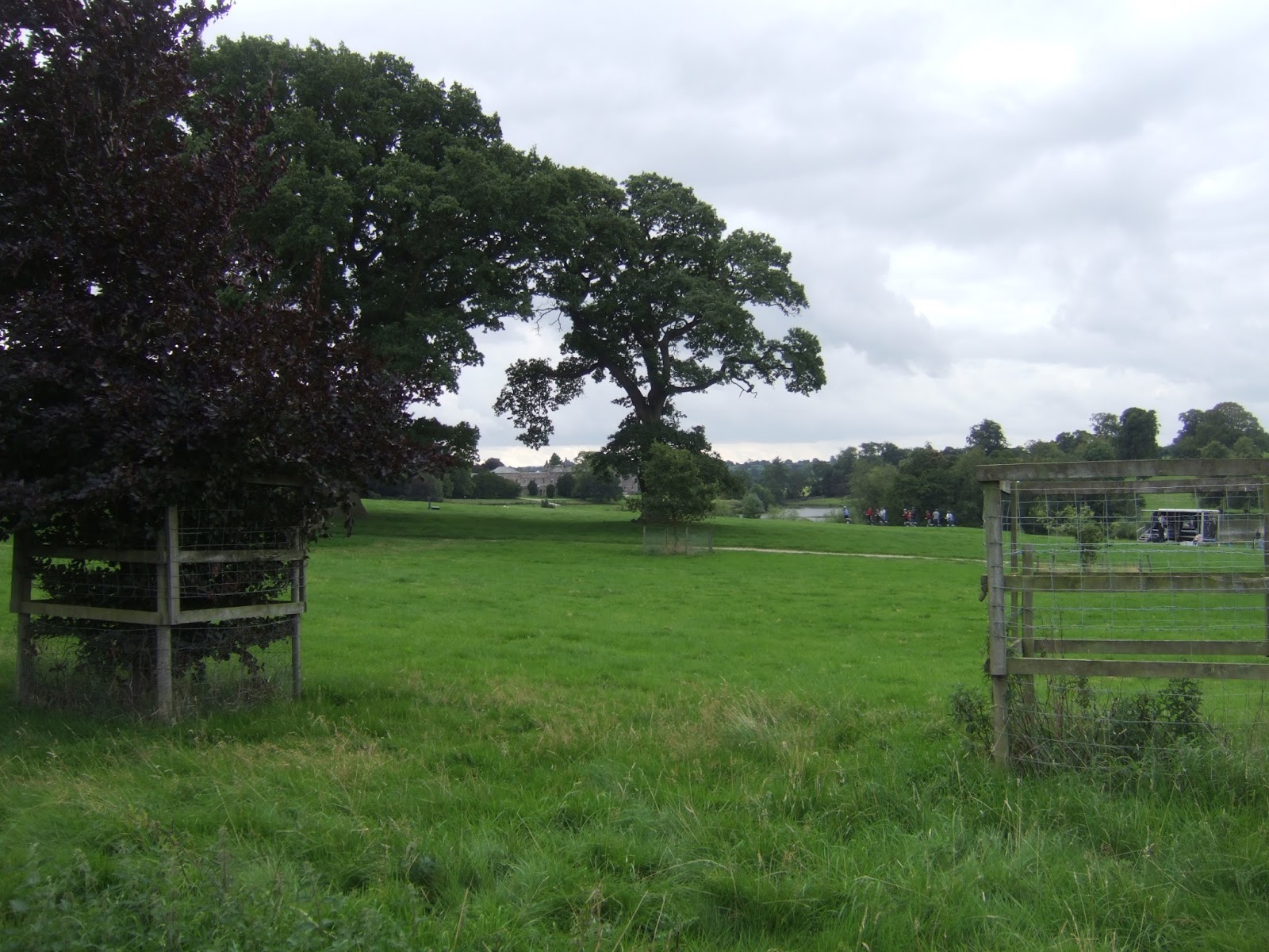
Railway walking done, and the last section of virgin territory between West Yorkshire and Nidderdale having been crossed for this year, we pass over the A61 and follow the Route 67 path along the edge of the fields to the south of Ripley, just as the sun decides to hide again, so the arrival in this model village, via the car park, has it looking as drab as it did a week ago, though distinctly busier as bank holiday tourist traffic rules the day. Pause for elevenses on a convenient bench, and then wander up past the Market Cross and the Boar's Head, noting that it's Scarecrow festival week in the village, as well as being a day for a number of charity drives, including car washing outside the Hotel de Ville, but having already seen most of Ripley this year, it's time to move on inside the loop of the Nidderdale Way and set course for the heart of the valley, starting off to meet the B6165 along that stretch of bypassed road that may or may not be private. Hitting the main road, its a huge relief to find that a footway exists, removed from the roadside, alongside the wall of the Ripley Castle, passing Scarah Farm and getting views across the park as the day warms through again, where Segway racing seems to be the order of the day among the manicured fields, and we continue on, shaded by many interesting trees, passing the end of Fountains Road and riding the road as it rollercoasters its way down to pass over Thornton Beck. We run out of path at Scarah Mill, a rare industrial survivor from the days of local production of woollen goods, and we've got traffic to walk against, mildly terrifyingly, as we hit the rising Whipley Bank, past Scarah Bank farm and getting some good views over to Kettle Spring Farm and this portion of the Nidd Valley previously seen on The Way, as we rise up to the hamlet of Bedlam. Apparently, it welcomes careful drivers, which amuses me no end, and even though its only part way up a 70+m push up from the beck, gaining a footway comes as a huge relief, as we hit the hilltop beyond the farm and cottage cluster to get a view back over the wooded hillsides around Harrogate, receding into the distance, as well as the sole view of Ripley village, hiding in the landscape. Press on with the footway, and feel like the familiar landscape is imminent again, as Knabs Ridge Windfarm rises to the south, whilst an impressive panorama to the north emerges to display Brimham Moor and its rocks, looking, as well as the woods of High Moor to its east, and whilst there's also a lot to see with the passage of Thornton Beck's valley, the route of The Way seems intent of hiding from the viewpoint up here.
 |
| The Market Cross & The Boar's Head, Ripley. |
 |
| Ripley Castle estate, with Segway racing. |
 |
| Welcome to Bedlam, Please Drive Carefully. |
 |
| The view to Brimham Moor and High Moor Woods. |
Burnt Yates village soon arrives, despite the signs saying its still over half a mile distant, and it seems odd that the village should exist in two halves, but it seems that suburban development has been attracted to this crossroads with the lane that runs between Clint and Shaw Mills, but it clearly had some significance in the past as home to the parish board school, and the New Inn, a small hotel complex that seems to be in need of a buyer, which is suggestive of another fantasy business opportunity. The school's presence explains the purpose of the pavement, for the safe passage of rural children, and the bus stop confirms my belief that the village does indeed have a service, but only on a Sunday, uselessly, and it's a short rise beyond to meet a bench with a viewpoint rose, an ideal spot to pause for lunch and to absorb the landscape around the Clint with Hamlets parish, which finally allows us to locate the passage of the Nidderdale Way in the valley to the north, and the route beyond towards Fountains Abbey, that isn't really that far removed from this landscape. The other half of Burnt Yates isn't that much further along, just past the cricket field, and displaying a whole mess of vintages in its buildings, with St Andrew's church and the CofE school being wholly Victorian and surrounded by cottages and houses that date from the 17th to 21st centuries, gradually accruing size but still sitting on a pretty small footprint, which means it retains a lot of charm (and has you wondering Who would actually want to commute from a remote corner like this?). A grand view over central Nidderdale appears from beyond the village, already seen from a variety of angles this year, and we'll depart from the main road here, not least because the footway disappears for a long stretch around the lower reaches of Hartwith Hill as the road undulates unduly, and cutting off a corner also makes sense if it give us more elevated views. So follow the signs for Brimham Rock, on the road that shares the name, and must surely be used by multiple roads judging by how many times I've crossed it, cutting a path north-westwards on a quiet lane that will keep throwing out random farm traffic, passing Winsley Hall farm, and getting quite a lot of bucolic splendour in as we follow the long drag over to Lawns farm and the Well House cluster, feeling hopeful that a good contextual view to the north will soon come along, as the valley view south remains familiar, soon gaining a look straight over to Brimham Lodge, with its many aerials, to let us know exactly where we are before we make our passage over the top of Hartwith Hill.
 |
| Burnt Yates, lower half, with the former board school. |
 |
| Clint with Hamlets Millennium Rose. |
 |
| Burnt Yates, upper half, with St Andrew's church. |
 |
| Bucolic splendour on Brimham Rocks Road, with Lawns farm. |
The way up starts on the long driveway up to Spring House farm, feeling slightly wary of the cattle in the not entirely enclosed fields, scaring the local pheasants as the road rises to the farm, and the path is directed out of the yard, but a large cow discourages me from entering its field, and so the private signs are ignored to pass among the under-employed sheds, to move behind the farm houses, which command a fine view to the south. Views aren't forthcoming from the path, hitting a field walk on the long strip of a meadow between two woodlands that offer no aspect north or south, so all attention goes forwards to the passage across the large field beyond the beck crossing, which unfortunately has a lot of young cows at its far end by our exit point, and as they start to move warily towards the intruder in their field, I'm struck by no mood to attempt to outrun them uphill to Edge Nook farm. So evasive manoeuvres are needed to dart behind a wall angle and over into an adjacent field, keeping low as I move stealthily out of the sight of the cattle to go a couple of hundred yards before popping up to see that the beasts' instinct to herd has mis-directed them, and I'm free of the risk of getting stampeded, and the fenced-off path can be joined to rise to Stripe Lane, to be mildly amazed that so much fresh territory has just been crossed in Lower Nidderdale. Get a fine view back down the valley from the top, 220m up, seeing that Harrogate still dwells on the horizon, with York surely sitting somewhere beyond it, but attention now goes forwards as the bridleway towards Summerbridge is joined, and Heyshaw Moor rises to give a completely different profile to the view, as the valley swing around from the rural greens of its lowest portion to the moorlands in its upper stretches.This heavily rutted track still offers some excellent profiles from Menwith Hill around to Thornthwaite as we progress west among these high, rough fields filled with sheep, before we meet an old rural cross roads and follow the rugged, enclosed track downhill, meeting a horse rider coming up who shares a bit of landscape instruction before we slip down onto the path through the waist-high bracken that leads, somewhat vaguely, into the freshly mown fields above Whin Busk farm. We're descending directly opposite the road that came down the southern side of the valley from Dacre, and we regain a hard surface past the farm, one that's now all prettified and follow its lane as it swings above Summerbridge to get a fresh view of the angle of the valley, running in to the edge of the village by its cluster of council houses, and onto the B6165 again.
 |
| Spring House farm, commanding a fine view. |
 |
| Dangerous moments with herding cattle on the way to Edge Nook farm. |
 |
| Heyshaw Moor and High Nidderdale from the high bridleway. |
 |
| Descending to Whin Busk farm, opposite the road through Dacre. |
It's safe passage among the terraces at the eastern end of the village after that detour and shortcut that proved more challenging than it needed to be, soon running up onto the corner by the Flying Dutchman from the third possible direction, where the general store and bus stand in Summerbridge have almost managed to become a home from home over this August, but this time we can carry on through this lovely settlement that can't quite figure out if it's a very small town or a very large village. It's got a pretty big school, as well as J.Todd & Son, who seem to be the Agricultural Supplier and purveyor of all necessary goods that acts as a magnet for most trade in this portion of the dale, and the houses along the main road feel far too substantial to be village-y, though it's only church is that of the Methodists, with the actual parish church being up in Hartwith, but it's got enough in it to claim small town status for me. Pause at the end of the village to finish lunch, starting to feel like I've down enough walking for today, but there aren't many more miles to go all told, so stick to the road and wonder why no effort was made to investigate the Nidd Art Trail, that is in place over this Bank Holiday weekend, before we run into the old mill complex at New York, which makes for an amusingly titled bus stand. Pavement endures as we run on, past the new fire station and out among the fields, that sit below the high wooded banks above Low Laithe, an intensely desirable spot that has a mill at its east end, and a fine run of houses that offer views across the equestrian farm and over the valley to the plantations on the south bank of the Nidd, where the pub is the Ye Olde Oak Inn, which is definite the third Oak-related tavern in the locality. Knox Hall provides a distinctive and curious house beyond the village, sat above the mill on the beck coming down from Smelthouses, and the pavement runs out as we meet the limit of Summerbridge's parish and have to join the roadside again on the modestly pitched ascent up towards Wilsill, getting some fine looks towards Guise Cliff and the mast above it, noting that the extensive tree growth on the banks below might make route finding in those parts difficult when my next High Season might bring me this way. Get one good look back down the valley from a fresh angle before the next village is met, again grown in a sporadic but fascinating way, with Victorian houses and rough farmsteads sharing spaces at the roadside, sometimes at awkward and dangerous angles, with the parish church of St Michael sat above it, a fine period reproduction in the Norman style.
 |
| Summerbridge's smart terraces & Methodist Church. |
 |
| Low Laithe. |
 |
| Guise Cliff and it's many associated plantations. |
 |
| Wilsill. |
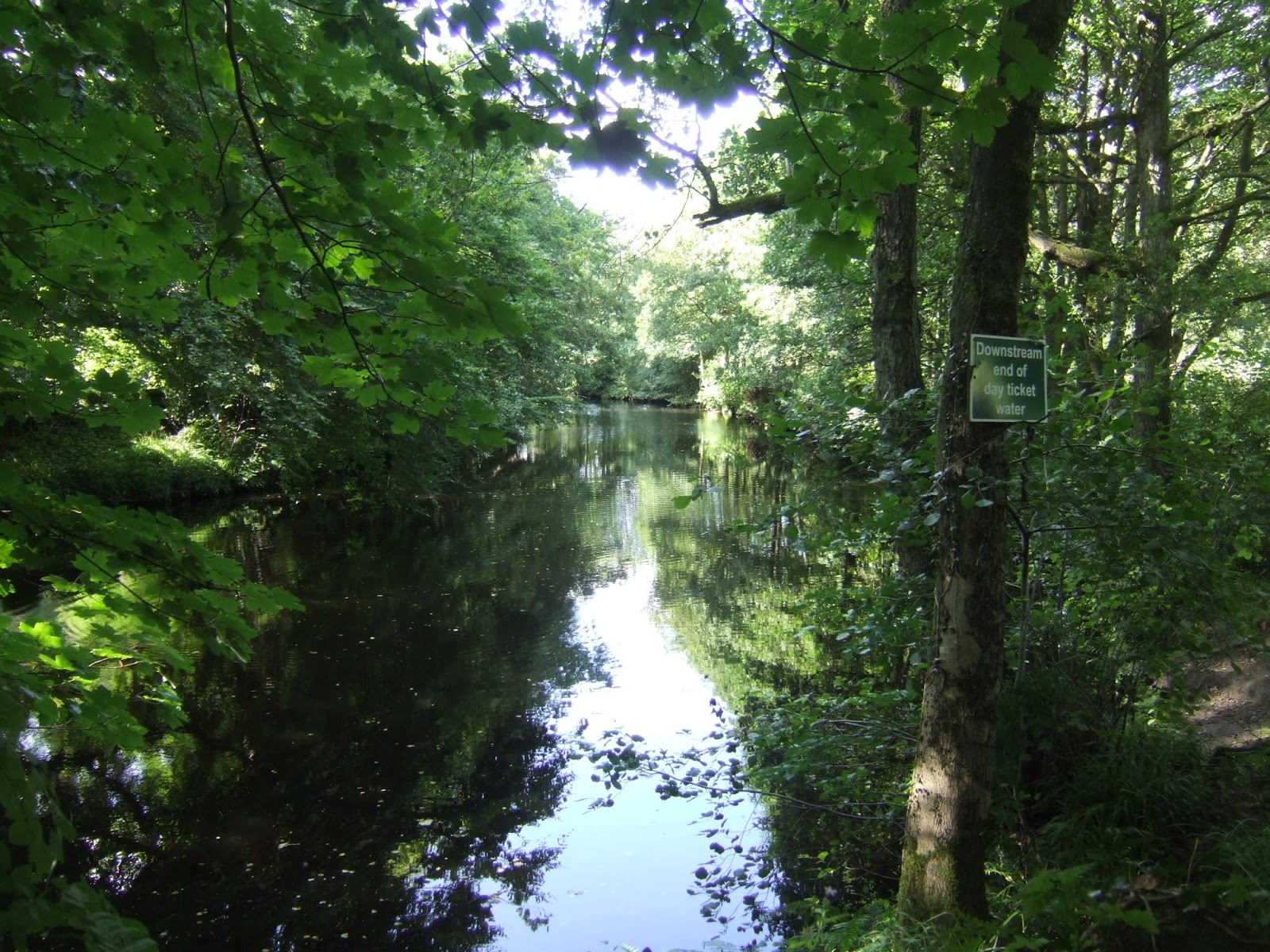
Also notable about Wilsill is the fact that is drinking fountains and water troughs are still operational, a rarity in this modern world, and once beyond Raikes lane, the mind can convince itself that we're now close to the end, as the Blazefield terrace sits a short distance away up the hillside, and the twists of the road soon advertise the valley of Fosse Gill descending down towards Bewerley on the southern side. Glasshouses is really only a couple of farmsteads and The Birch Tree beyond, where a rest room break is most welcomed before we depart the main road to drop down the lane towards the village green and the old chapel to note that more than anywhere else in the valley, the suburban splurge has landed here, though not in an entirely uncharming way, it has kept the village school in business and managed to keep the old Station house alive, and if we're crossing the old railway again, the finish line must be close. A small detour is needed before we meet the Nidd again, though, as Glasshouse mill demands a closer look, grown to impressive size in the 19th century, it now stands semi-derelict after only recently passing out of use completely, and it looks ripe for redevelopment in an out of the way corner, demanding many pictures before we head for the riverside walk, initially alongside the large millpond that now resides as a quiet rest spot for local wanderers. Tree cover comes over to provide shade along the goit channel, followed until we meet the riverbank above the weir, noting the inaccessible bridge over to Castlestead house and following the riverside meadow along, the air thick with the smell of Balsam. We must be pretty close to our residence spot at Bewerley hall down here, faintly glimpsed through the trees, as we move to meet the railway route once again, clearly traceable in both directions and making me desire the Sustrans treatment for it before we pass below Harefield House, the magnetically attractive hotel and pub at the eastern edge of Pateley Bridge. The riverside path then leads us into the end of Nidd Walk, where the goods yard of the NER branch once stood, with some brick retaining walls enduring and a public sculpture sitting on the turntable site, but most of the former railway has been lost below a car park and serviced flats, though we can be very happy that the station building has survived in residential use, despite having not seen a paying customer since 1951, and that means we've arrived at our destination, happy to get in quite so much Nidderdale in when travelling from home.
 |
| The Birch Tree, and Glasshouses. |
 |
| Glasshouses Mill, in need of love. |
 |
| The Nidd riverside. |
 |
| Pateley Bridge station. |

Day done at the King Street bus stand at 4.10pm seems like good progress timing for the day, having successfully stitched together the two walking fields of this year's High Season but it's actually pretty poor because I'd hoped to get my tea at the Pancake House, having had a hankering for some crepes since our brew stop in May, but that's not to be as the half hour lost at the start of the day leave me with only 20 minutes until my ride on the #24 and would involve far too much loitering if I chose to eat and then had to catch the 5.30pm bus, along with so much of the day being devoured by the ride home. That will have to wait for another day, as the high season has brought a distant district much closer to home, along with the belief that a little bit of focus and a lot of good time management can make even the apparently remotest corner of the county seem a lot more accessible, and so Nidderdale will be back on my walking slate in 2018, be it explored with parental assistance or done by the power of public transport, I will be back in this valley very soon, mark my words!
5,000 Miles Cumulative Total: 2980.1 miles 2017 Total: 415.1 miles
Up Country Total: 2720.6 miles
Solo Total: 2723.8 miles
Next Up: On the Idle Hill of Summer.


 Day done at the King Street bus stand at 4.10pm seems like good progress timing for the day, having successfully stitched together the two walking fields of this year's High Season but it's actually pretty poor because I'd hoped to get my tea at the Pancake House, having had a hankering for some crepes since our brew stop in May, but that's not to be as the half hour lost at the start of the day leave me with only 20 minutes until my ride on the #24 and would involve far too much loitering if I chose to eat and then had to catch the 5.30pm bus, along with so much of the day being devoured by the ride home. That will have to wait for another day, as the high season has brought a distant district much closer to home, along with the belief that a little bit of focus and a lot of good time management can make even the apparently remotest corner of the county seem a lot more accessible, and so Nidderdale will be back on my walking slate in 2018, be it explored with parental assistance or done by the power of public transport, I will be back in this valley very soon, mark my words!
No comments:
Post a Comment