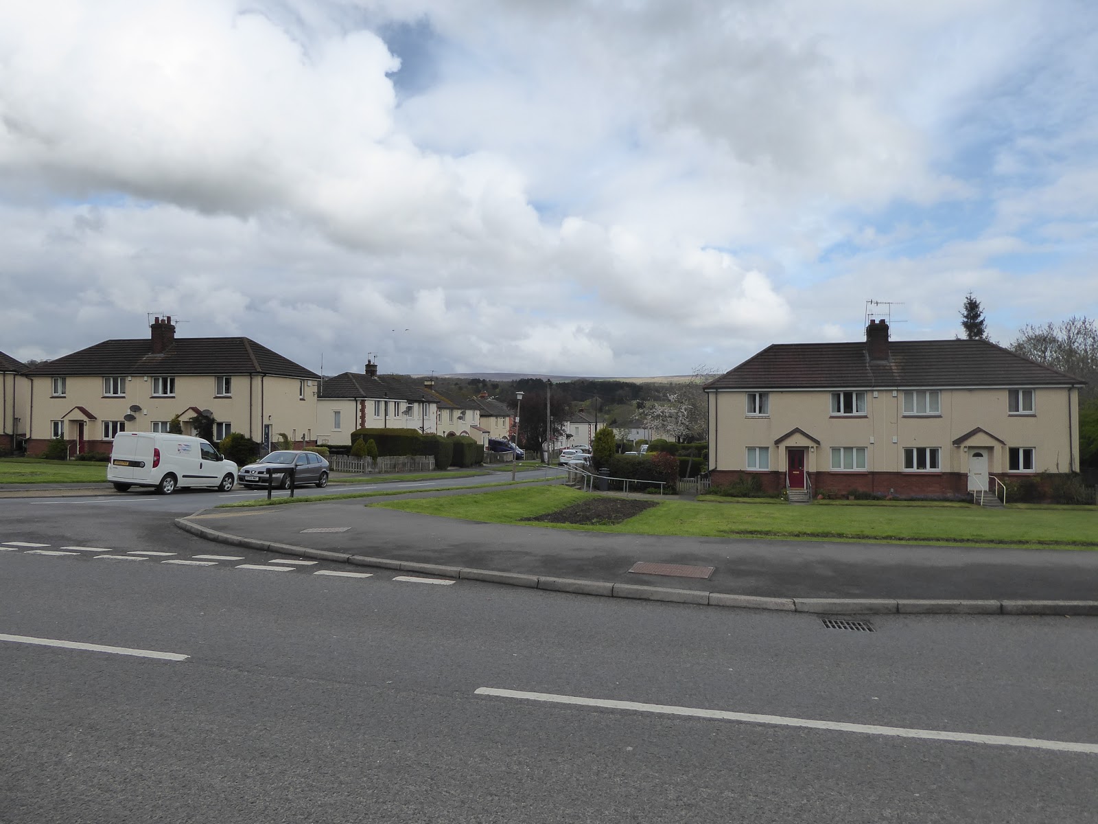
It was a works outing on Friday night, with 13 of us sitting down for dinner (somewhat ominously) at Red Hot Buffet to get in multiple plates of All-You-Can-Eat, on one of those occasions that thankfully didn't see my drinking exploits stretching long into the evening, so that a hangover doesn't have to be worried about as the following morning rolls around, though I am still feeling the bloat some 14 hours later as I get up to face my next trail. It's also about time that I sought out a new station, as there haven't been any this year so far, so ride out to Wharfedale to pick out a track to Airedale, a minor theme for this portion of the season, while the weather takes a turn that has it looking a lot more like late April than it did last week, alighting at Ben Rhydding station at almost 10.05am. The track naturally takes us westwards, down Wheatley Lane and under the railway bridge, along the narrow footway to take the turn onto Valley Drive, where the definitively not posh quarter of Ilkley resides, the north east portion being where the modest semis and council houses reside, away from the upscale living in the other three quarters, probably still expensive in the scheme of things, but certainly the only part of town I could afford to retire to. I've made a lot of the views of the looming edge of Rombalds Moor above the town on previous trails, so stick to the south side of the road so a view or two might be picked out towards Denton Moor and Round Hill rising above Middleton on the north bank, above the rooftops of suburban Ilkley. Pass an incongruous section of dual carriageway at the heart of the estate, and over Backstone Beck at its western edge before we join Little Lane and follow it into a landscape of blackened terraces and light industrial buildings which fill all the space below Leeds Road, met by the cinema and crossed over to pass between the school, the conservatory outlet and lawnmower supplier on Wharfe View Road, before arriving at the Riverside Gardens by the Ilkley Playhouse. Descend to the path by the Wharfe and pass below the New Brook Street bridge, and along the length of the popular parkland to meet the Old Bridge, and the Dales Way seat, still obscured by the wares of the local nursery, and join the long route to Bowness for a second time as I fear that obvious fresh routes through Ilkley are starting to run a bit thin. Thus we'll have a bit of a nostalgic trek down the riverside in the shadow of Myddelton Lodge before meeting the driveway to the Ilkley Lawn Tennis & Squash club, where many legs appear to be flailing around in the upstairs picture windows, as part of a keep fit class, I'd assume.
 |
| Denton Moor above Ilkley's Suburbia. |
 |
| Leeds Road, Ilkley. |
 |
| Hello again to the start of the Dales Way. |
 |
| Field Walking in the shadow of Rombalds Moor. |
I'm still wearing my lightweight road boots for this trip, three months into the season, which turn out to not be the best footwear for cross-countrying it over the fields of Hadfield farm, where a few gateways have gotten some very sticky pools developing, while the views give quite a different perspective to the moorland edge, the old railway embankment and the profile of the western edge of town to the ones we has from only a couple of hundred yards to the south last weekend. Meet the bank of the Wharfe again, on the rising and falling path behind The Hollins and opposite the Ilkley golf course on the north bank, before joining the rough meadows below the road towards Addingham, sticking close to the bank to observe the rocky scars on the north side and protective screen of fallen trees that has piled up on the south. On meeting Ilkley Road, we need to switch-back a short distance to meet the rising rough path up through the trees to the side of the A65, crossing over to join Cocking Lane, where a cycling party on a trip from Blackpool to Grimsby is receiving support, and if they set off this morning, they are going great guns so far, achieving something far more notable than my trip for the day. Back on tarmac, our ascent starts pretty swiftly, passing over the old line from Ilkley to Skipton and getting no sense of it whatsoever, whilst also trying to get a fix on where the path previously walked down from Cragg House and over to Addingham might have joined this undulating lane as it passes over the Hall Gill and Lumb Gill cloughs, before hitting the rise that reveals the cleft of Wharfedale's receding valley to the east and the looming hills to north and south. The rising lane to the farm cluster at Small Banks reveals a whole bunch of views to warm the heart, with Beamsley Beacon the most prominent, with Barden Fell also rising high, and once past this post agricultural hamlet-let we also see Great Whernside and Meugher appear, far off above Upper Wharfedale. The attention almost forgets to be drawn towards Addingham High Moor, as the lane passes between Gildesber and High Brockabank farms, with the passage of the Bradford Millenium Way, as the road rises further up towards Nudge Hill farm on the edge of Addingham Middle Moor, as the view to the ridge of Skipton Moor emerges and the view to Upper Wharfedale gets enhanced. Despite this being only a medium height walk, only 275m or so up, it's a special sort of panorama to see as the road hits its highest points, with the sunshine arriving to bathe Upper Wharfedale in a warmer tone before we can look forwards again, to see Pendle Hill peek above the horizon and see Nab End rise at the western end of Rombalds Moor, with the lane leading us now past the Otley & Colne milestone and on towards Airedale.
 |
| The Wharfe below Low Mill. |
 |
| Cocking Lane and the paths down from Cragg House. |
 |
| Small Banks farm cluster / hamlet. |
 |
| Ascending Nudge Hill to Addingham Middle Moor. |
 |
| The View Back to Wharfedale. |
It's only a half mile trot across the road summit, but it provides quite an aspect as we shift away from Wharfedale to Airedale, bringing with it the surprise that a supposedly familiar landscape can shift so dramatically from a different elevation, passing the roads up to Addingham Moorside and Light Bank, and the splendidly located Sea Moor farm, all in the shadow of the Nab End of Rombalds Moor before we meet the caravan park at the top of Brown Bank. An odd place to want a mobile home, especially as the road starts a sudden and steep drop just beyond it, so wits are sharpened to keep away from the traffic that only seems to use this end of the road, passing through the many Gorse bushes with Silsden laid out before us down the valley side, with Earl Crag presenting itself far across the Aire. As landscape features go, it's a useful one, as this portion of Airedale isn't especially distinctive from up high, as Keighley Moor and Boulsworth Hill do not have mush by way of shapely distinction, whilst Ovenden Moor is only familiar because of its wind farm, though as the lane snakes downhill past Crag House and Well House farms we do get sight towards Silsden Reservoir beyond the A6034, and up to the deveoploing profile of the south west edge of Rombalds Moor as Brunthwaite Crag, Rough Holden and Rivock Edge reveal themselves. It's a steep descent to get to the main road, passing Raikes House and pondering where the Millennium Way might have passed this way in 2013, at the top of North Street, where the suburban growth of Silsden has spread, on the other side of Bolton Road, which quickly reveals why it got bypassed a long time ago as the road into the town steepens and narrows, with terraces squeezed right up to the roadside down to the beck and the site of the former mills. Bridge Street forms the centre of the town, where the Co-op and social club share a site, and the pubs sit at angles suggestive of old alignments, with tiny roads branching off to old stores and small sites of former industry, but further investigation will have to wait as our route leads up Skipton Road, up through the landscape of terraces that render Silsden distinct from the east, which look like the main road facing ends were built to house the senior staff of the period, with the general workers in the modest house off to the sides. I don't think I was prepared for the uphill pull out of town, proving that I really don't spent enough time absorbing the landscape on my maps when the routs are so easily retained, as we pass into a much more suburban landscape as the road rises, ensuring that looks back are taken regularly to the receding Nab End and the view down the Aire valley.
 |
| The Nab End, relatively close up. |
 |
| Descending Brown Bank, towards Airedale. |
 |
| Bolton Road, carefully bypassing Silsden. |
 |
| Descending North Street, Silsden. |
 |
| Ascending Skipton Road, Silsden. |
Beyond Low Cross Moor farm, which definitely needs a spruce up, we are back into the countryside again, and the view across Airedale comes on again, which needs some careful interpretation as we are already beyond Steeton, and it must therefore be Eastburn down at the valley bottom, with Airedale General Hospital in among it, and the view back is grand too, with Rombalds Moor looking particularly massive, and the road and railway down the valley looking like models. Passing beyond High Mark, Near Woodside and Lane House farms, its frustrating that there are no good northwards views towards Skipton Moor, as the fields riseat a pitch that too steep to reveal anything beyond, so we stick to looking into the valley, and attract the interest of a field full of cows, who do not like the attention at all. Next up, we run past Kildwick Grange, which seems to have a collection of ancient farms at its centre, but they are mostly hidden by more recent houses built around them, creating an odd little suburban hamlet above the valley, soon left in our wake as Earl Crag returns to dominate the southern horizon, with Cross Hills / Sutton in Craven / Glusburn spread out below it, all still unseen up close. Passing Priest Bank Top, we start to run in close to Kildwick, spread down the hillside below, though the extremely gorgeous 17th century Kildwick Hall is very visible from the road, usually close actually, with its summer house on its front yard, and the formal gardens arranged across the lane, with an array of farm buildings associated to it on the western side. Despite passing above the village, there's still an array of farmsteads an cottages to pass on the undulating Grange Road before descending sharply through the woods that offer paths up to Farnhill Moor, to meet Main Street and passage above the Leeds & Liverpool canal and through the hamlet of High Farnhill, in the shadow of the moor and distinct from the village down below. We pass a very impressive barn, and the lump that has Farnhill Hall on it as we finally drop into the Aire Valley, to pass over the canal and meet the A629, getting the reveal upstream to Flasby Fell, and the other hills of Upper Airedale as we go, along with site to our destination. So hot feet on for the blast down among the meadows by Cononley Lane, noting that the Aireside Mill site has been redeveloped with new houses to sit by the old terrace before passing over the Aire via the 1928 bridge to see that Station Mill is getting a post industrial makeover for the commuter set, located by the station for the village beyond the railway lines, not to be seen today as a new station for 2018 is met at 2.15pm, the first on the Skipton Line beyond the WY Metro area, and the finish line for today.
 |
| Rombalds Moor's profile, from the west. |
 |
| Earl Crag, Airedale's Best Hill. |
 |
| Kildwick Hall, Grange Road. |
 |
| Farnhill Hall, and the Leeds & Liverpool Canal. |
 |
| Station Mill, and company, Cononley. |
5,000 Miles Cumulative Total: 3218.5 miles
2018 Total: 106 miles
Up Country Total: 2930.7 miles
Solo Total: 2939.7 miles
Miles in My 40s: 1812.3 miles
Next Up: A Bank Holiday weekend circuit of Rombalds Moor!


No comments:
Post a Comment